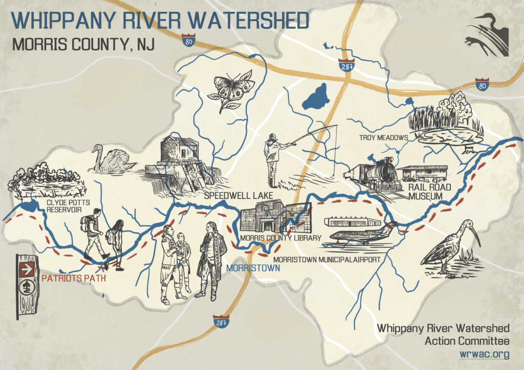
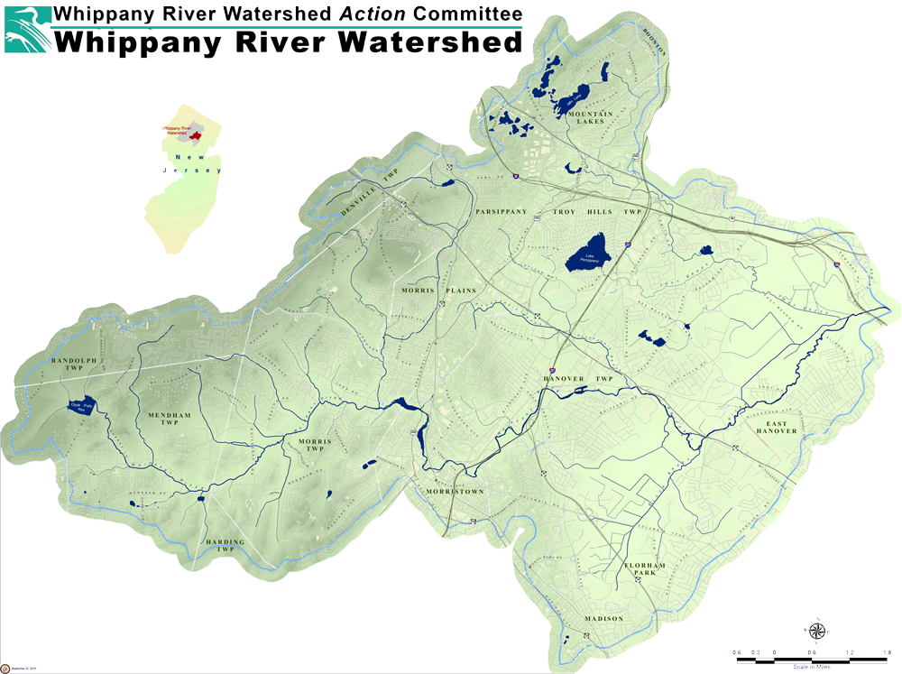
The Watershed
The Whippany River Watershed is an area of 69.3 square miles in Morris County, New Jersey that contains all of the small streams and tributaries that drain into the Whippany River. This 16-mile long river is one of the sources of drinking water for more than a million people in northern New Jersey.
Watershed Information
- What Is a Watershed booklet about New Jersey’s watersheds.
- Whippany River Watershed’s HUC 14’s Sub-watersheds
Chronolog
Time lapses powered by citizen science
Chronolog crowdsources time lapses to tell stories about our environment. Speedwell Lake has a long history and is one of Morris County’s most recognizable landmarks.
https://wrwac.org/index.php/resources/chronolog/
Photos on Google Map
NJ Conservation Blueprint Map
Click the link below to use the New Jersey Conservation Blueprint interactive map where you can view different layers of geographic attributes.